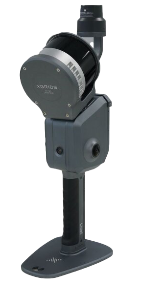
Real-time Scanning & Modeling Device
The new Lixel L2 Pro combines LiDAR, visual, and IMU modules with AI, delivering real-time point cloud data that rivals post-processed quality.
Fully integrated and deeply optimized
Rotating LiDAR
Active scanning mechanism captures dense point clouds with precision depth data.
True SLAM with real-time output
The real-time coloring effect rivals post-processing quality. L2 Pro delivers instant results with no waiting.
The LixelUpSample™ Algorithm
Generating photo-quality color point clouds with unprecedented density. 1 million points per square meter with 1mm spacing captures every detail with precision.
Ultra-Dense Coverage
1mm point spacing for millimeter-level detail
5mm Cloud Thickness
Precise surfaces for accurate mapping and line drawing
Photo-Quality Colorization
Ultra-high coloring accuracy from dual 48MP cameras
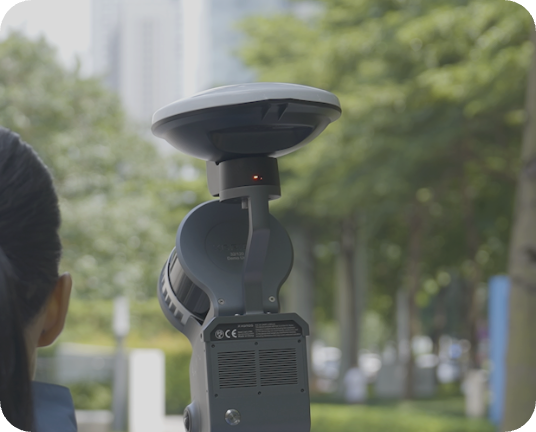
Reliable SLAM for complex environments
Exclusive Multi-SLAM algorithm enhances adaptability and reliability in challenging environments. Provides continuous absolute coordinates even in satellite-signal-limited areas like indoors or underground.
Indoor Spaces
Works without GPS/satellite signals
Underground
Tunnels, subways, and mines
Featureless Corridors
Texture-less environments
Absolute Coordinates
Continuous positioning (WGS84/CGCS2000)
Maintains accuracy with RTK disconnection up to 100m
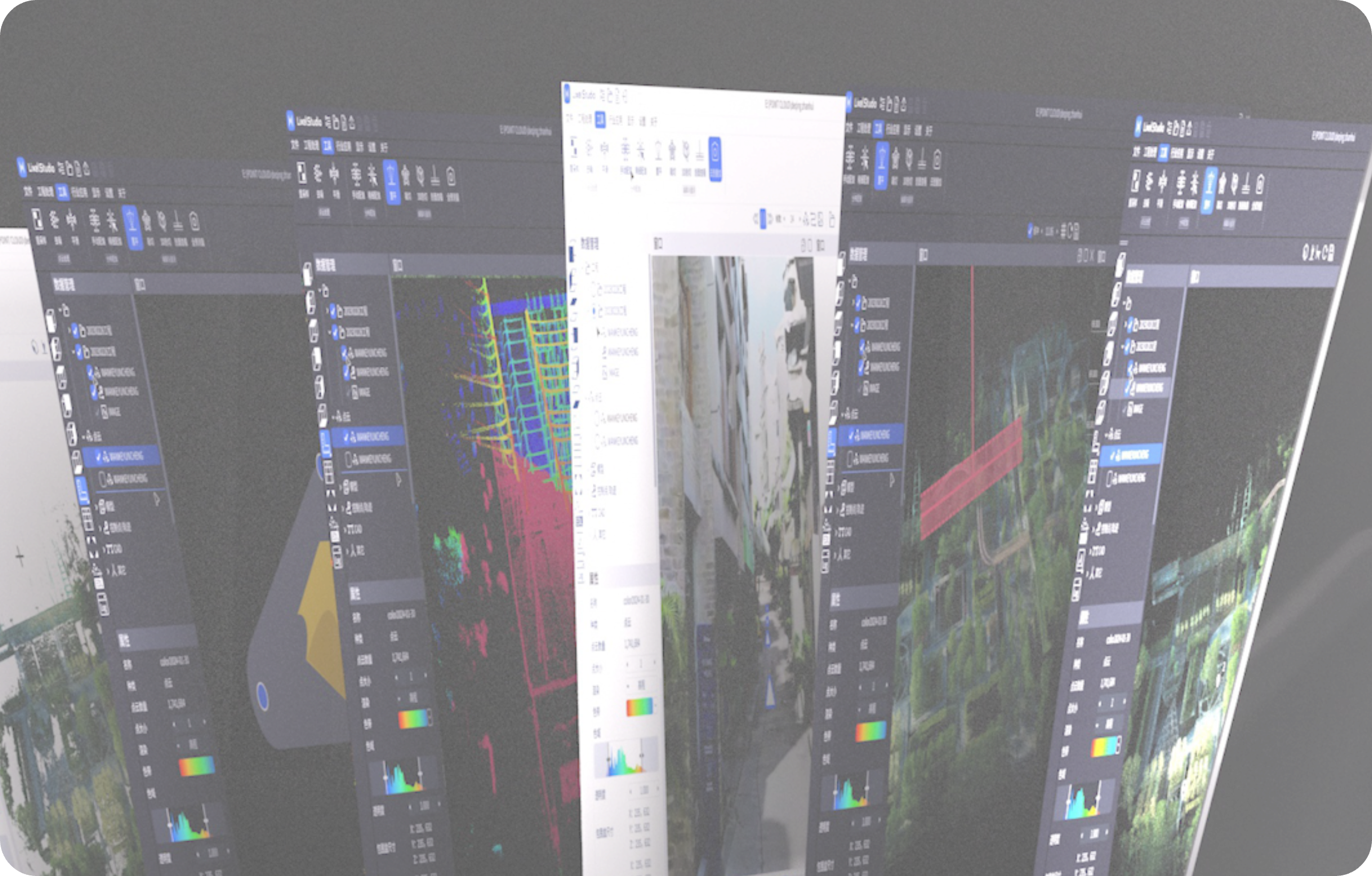
A seamless, user-friendly workflow
Easy control with one screen, one-click operation. Full process operations including RTK setting, breakpoint rescan, and real-time visualization.
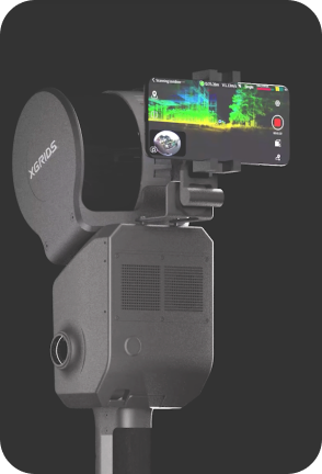
Direct Phone Connection
Real-time monitoring without a PC. Control everything from one screen.
One-click GCP Marking
Mark ground control points instantly for survey-grade accuracy.
Precision Verification
Real-time viewing of camera images, elevation, and true-color point clouds.
Breakpoint Rescan
Resume scanning from any point. No need to start over.
Maximize usability and flexibility
A complete ecosystem of accessories for any scanning scenario.
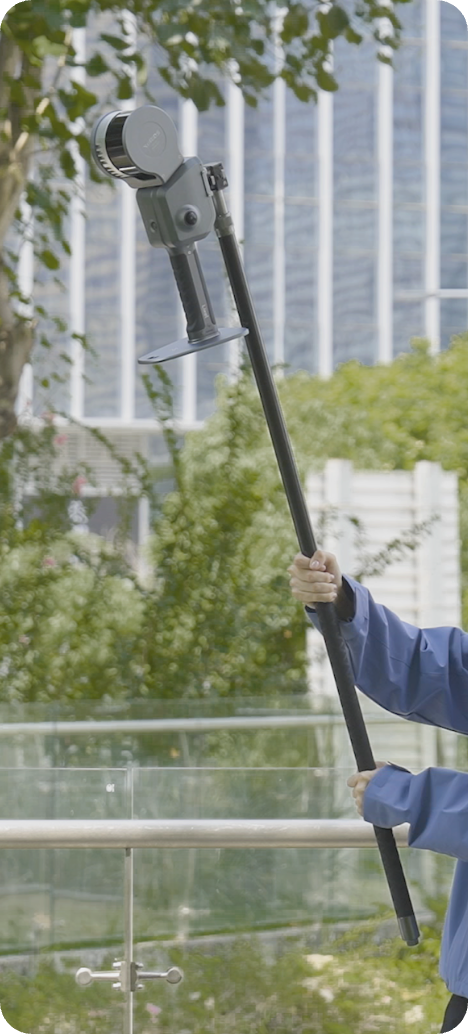
Extension Pole
2m extension for high ceilings and hard-to-reach areas
RTK Module
High-precision GNSS for absolute positioning
Phone Mount
Secure mount for real-time monitoring
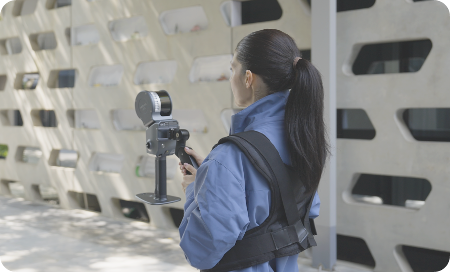
Supporting Harness
Ergonomic harness for extended scanning sessions
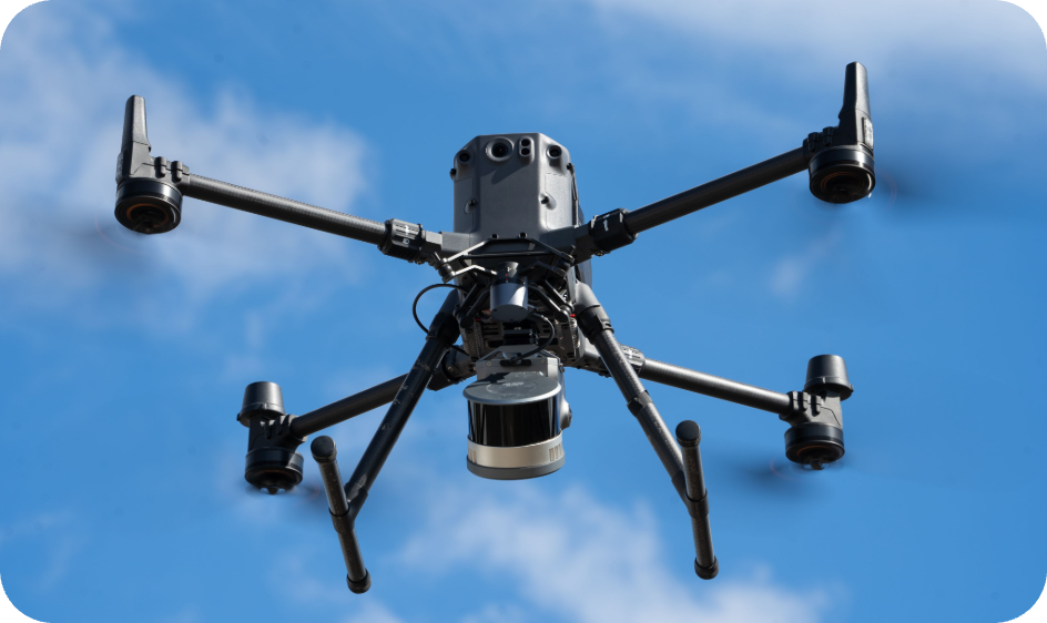
Drone Mount
Aerial scanning capability for large areas
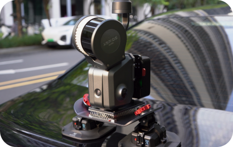
Vehicle Mount
Mobile mapping from any vehicle
All-in-One Point Cloud Processing
Free 1-Year Splat Labs Starter Plan
When you purchase the Lixel L2 Pro through Splat Labs, you receive a free year of our Starter Plan (a $144 value). Process and host your point cloud data on our platform.
Powered by
L2 Pro captures are processed and hosted on Splat Labs—the leading platform for 3D Gaussian Splat hosting and collaboration.