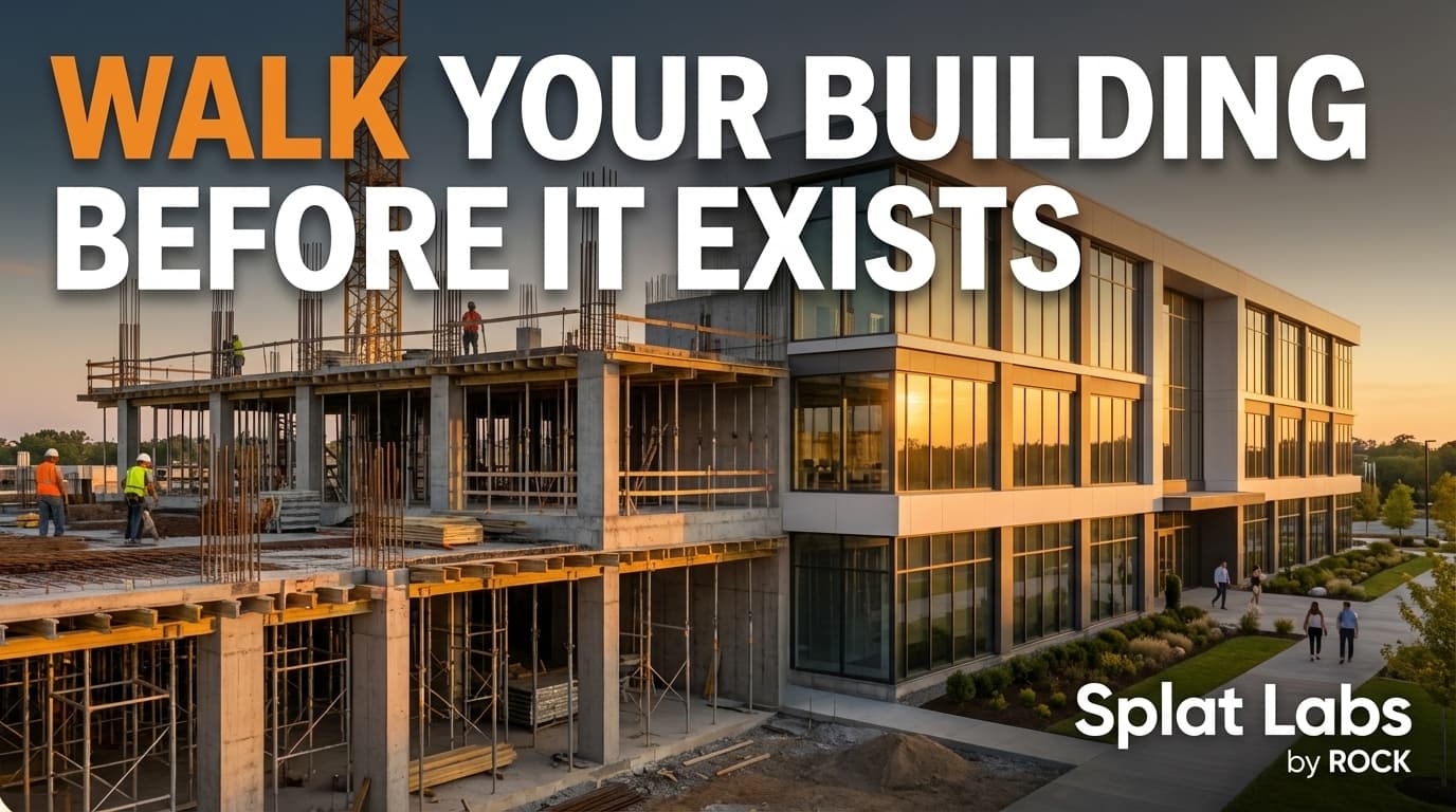
We went to an active construction site, came back three weeks in a row with a PortalCam, and built a 4D timeline of the entire project in Splat Labs. The video above walks through every detail — but if you want to dig deeper, keep reading. And you can explore the actual dataset yourself right here:
Three Weeks of Construction in Photorealistic 3D
Each capture took about 30 to 45 minutes — just walking the job site holding a PortalCam. No survey crew, no specialized training. Here's what changed week to week.
Week 1: The Baseline
The crew was setting up formwork for the basement walls, getting ready for the pour. Off to the side sat a massive spoil pile from the initial dig. On the existing foundation next door, they were just finishing decking the subfloor — the wood platform the rest of the house would stand on.
Week 2: Vertical Progress
One week later, the difference was dramatic. The forms had been stripped and the concrete foundation walls were fully cured and exposed. You can even see the rebar dowels sticking up, ready for the next level. The framing crew had moved from subfloor to vertical framing, with the rear exterior walls already standing.
Week 3: Earthwork and Framing Complete
Week three was the massive payoff. That huge dirt pile? Gone — used to backfill the foundation, filling the gap between the concrete and the earth to stabilize the structure. They also completed the mass excavation for the next unit over. Three weeks of work, fully documented in photorealistic 3D that anyone on the team can pull up, scrub through, zoom into, and share.
The Capture: How Simple It Actually Is
If this is the first time you're seeing a Gaussian Splat on a construction site — this is real. This is where the technology is right now.
The hardware has gotten smaller, faster, and more affordable. The processing that used to take hours now happens in minutes. Each of these captures was made by walking the site holding a PortalCam. That's it. Anyone on your team can do this — hand them the device, they walk the site, and this is what you get.
And here's the prediction: what you're seeing right now is just the beginning. In the next six months the price of these devices is going to drop even further, and the quality is going to improve even more dramatically. There are going to be more devices, more options, and we'll be covering all of them. The capture side is solved — the technology is there, the price has come down, the barrier to entry is basically gone.
The Real Challenge: What Happens After Capture
The real challenge now is what happens after the scan. Where does this data live? How does your team access it? How does it plug into ACC, Revit, ArcGIS — the platforms you're already running every day?
If you're running construction projects, you're already in Autodesk Construction Cloud, Procore, or PlanGrid. Managing infrastructure or utilities? ArcGIS. You have systems, your teams know them, they work.
But now there's an entirely new type of data — photorealistic, navigable 3D models of your job sites, your buildings, your entire asset portfolio. You need somewhere to host them, organize them, share them across your organization, and plug them into the platforms you're already using.
That's what we built Splat Labs for.
What Splat Labs Gives Construction Teams
Organization and Sharing
Create projects, organize them into folders, and share individual projects or entire folders with your team or your clients. Every project gets an embeddable link — drop it into ACC, embed it in an ArcGIS dashboard, reference it in Revit, put it on a project portal. It works everywhere.
Measurements and Comments
Need to verify dimensions or check clearances? Take measurements right in the 3D model. Need to communicate about something on site? Leave comments pinned to the exact spot in question. Your PM drops a comment right where the problem is and the whole team sees it. And soon those comments will sync directly with issues in Autodesk Construction Cloud — flag it in the 3D model and it shows up as an issue in ACC automatically.
Walkthroughs and Fly-Throughs
Generate cinematic fly-throughs right from the viewer for client presentations. Or set up guided walkthroughs — place clickable points on the ground just like Matterport, and your viewer clicks from spot to spot through the space. It's a more seamless experience for clients and stakeholders who want to explore without figuring out 3D controls.
Portals: Connect Multiple Scans
If you've got multiple scans — room by room, exterior to interior, multiple floors — connect them together with portals, enabling you to click from one scan to the next and tie the whole site together as one navigable experience.
4D Timeline: Track Progress Over Time
Upload multiple captures of the same site and Splat Labs gives you a 4D timeline — toggle from scan to scan and see exactly how the site has changed from one visit to the next. This is the core of what we demonstrated with the three-week construction series. Anyone on the team can scrub through the timeline, zoom into any area, drop a comment, and share it with a client.
AI Features
The AI floor plan generator takes your Gaussian Splat and creates a floor plan from the 3D data — and we're building it out to do much more than floor plans. Site maps, asset tagging — the AI reads the 3D model and extracts usable information, and that capability is only going to expand.
AI virtual staging lets you restyle any space right from the viewer. Furnish an empty room, redesign an existing one, type in whatever you want and the AI generates it. It's a powerful tool for real estate, design visualization, and showing a client what a space could look like.
Cloud Processing (Coming Soon)
Here's something nobody's talking about yet. That 45-minute capture? It took about 12 hours to process on a high-end machine — a 5090 GPU, 128 gigs of RAM, high-end AMD processor. Now think about what happens when you deploy these at scale. Five or ten units in the field, each capturing two or three sites a day — that's 20 or 30 splats to process every single day. Hundreds of hours of GPU time. It becomes impossible to keep up without a massive hardware investment.
We're building cloud processing right into Splat Labs. Upload the raw data, our GPU cloud handles the processing, and you don't have to think about any of it. That's coming soon as part of the enterprise plan.
Enterprise Controls
For larger organizations — roles, permissions, and white-label branding so clients see your company, not ours. Full access control built in. And everything works on mobile. Your client opens a link on their phone and they're walking through a full photorealistic 3D model — no app, no download.
For Service Providers
If you're a service provider capturing for clients — think about handing them a deliverable that plugs straight into their ACC or ArcGIS. That's a very different conversation than giving someone a standalone 3D model. And if you're inside a larger company trying to get buy-in for this technology — show someone the 4D timeline. That conversation gets short real fast.
How This Fits Your Existing Workflow
This isn't meant to replace your 360 photos or daily progress shots. Most teams are still doing those — photos every day or every couple of days, regular cadence.
But when you hit a major milestone — before the concrete pour, right before MEP goes in, after MEP is complete — that's when you do the full Gaussian Splat. That's when you want every detail captured in photorealistic 3D, before things get covered up and before the walls close in. You're creating a permanent, navigable record of that moment.
| Your Existing Workflow | Add Gaussian Splats |
|---|---|
| Daily/weekly progress photos | Continue as normal |
| Milestone documentation | Full 3D Gaussian Splat capture |
| Photo folder archives | 4D timeline in Splat Labs |
| Flat progress reports | Interactive 3D walkthroughs |
| Email photo attachments | Shareable viewer links |
The daily photos handle the day-to-day. The Gaussian Splats capture the milestones in full detail. And as capture gets faster and devices get cheaper, this is only going to shift more toward Gaussian Splats being the majority of your documentation — especially as more AI tools get built on top of these 3D datasets.
Explore the Dataset and Get Started
The full 4D timeline from this video is live on Splat Labs right now. Spin it around, scrub through the three weeks, zoom into details. Use the embedded viewer above or open it directly in Splat Labs.
Ready to start capturing your own construction progress in 3D?
- Try Splat Labs free — Sign up at splatlabs.ai and upload your first splat
- Get a PortalCam — When you buy through Splat Labs, you get a free Starter plan included so you're capturing and hosting right out of the box
- Enterprise plans — For larger teams with multiple devices and sites, see our pricing or contact us to discuss your deployment
Want to see how Splat Labs connects to your existing tools? Read How to Use Gaussian Splats with Autodesk Construction Cloud for step-by-step integration workflows. Questions? Drop them in the YouTube comments or contact us directly.